Dijon, France/dijon610
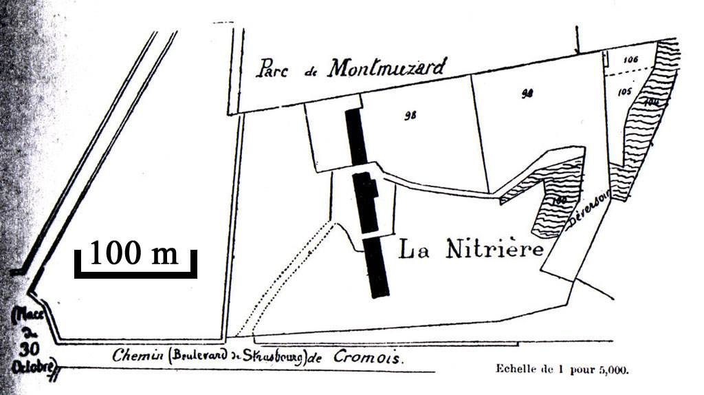
Previous | Home | NextBy the late 1700s the French authorities were urgently searching ways to increase saltpeter production. In 1780 the Saint Médard Nitrière was specifically established and Jean-Baptiste Courtois was made manager. In 1788 the Courtois purchased the refinery and the family moved there a year later. Bernard lived here until 1795. This was the main producer of saltpeter in Dijon at this critical time. This map of the Saint Médard refinery dates from 1812 (le plan cadastral) and can be matched with the Dijon map ("3"). The intersection at the extreme left is known today as Place du 30 Octobre (erected to the glory of Dijon who resisted the German armies in 1870). The east-west road at the bottom, Chemin de Cromois, is now known as the Boulevard de Strasbourg. (Fragmented sections of Chemin de Cromois still exist in the eastern suburbs of Dijon). Today there is no hint of the Nitrière, either in buildings or names of streets. The park "Parc du Montmuzard" is the general area which is still known by its highest point (see next photo).
